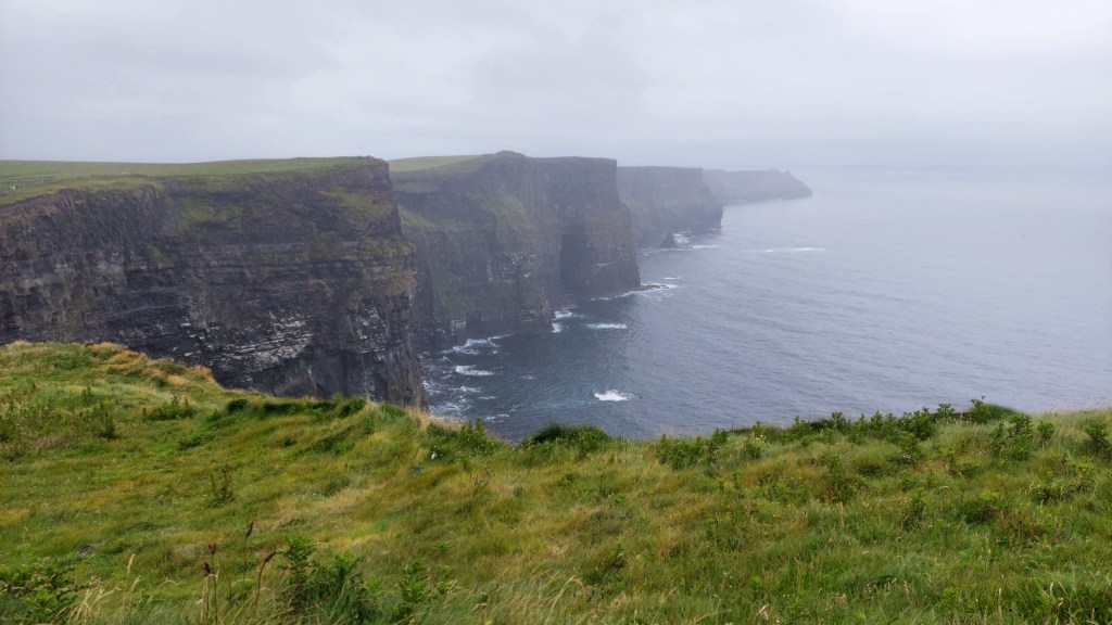
Any day I get to spend in nature is a day I treasure. Even though I discovered my love for hiking later in my life, I will be forever glad that I did. For me hiking is an escape where I can find inner peace and completely shut off from the busy everyday life. Time seems to flow differently when you’re in the mountains, and you can get completely ‘lost’ while walking through the pine forests and upon the rocky cliffs.
And I am also so very lucky to have the best hiking buddy out there – my sister! <3
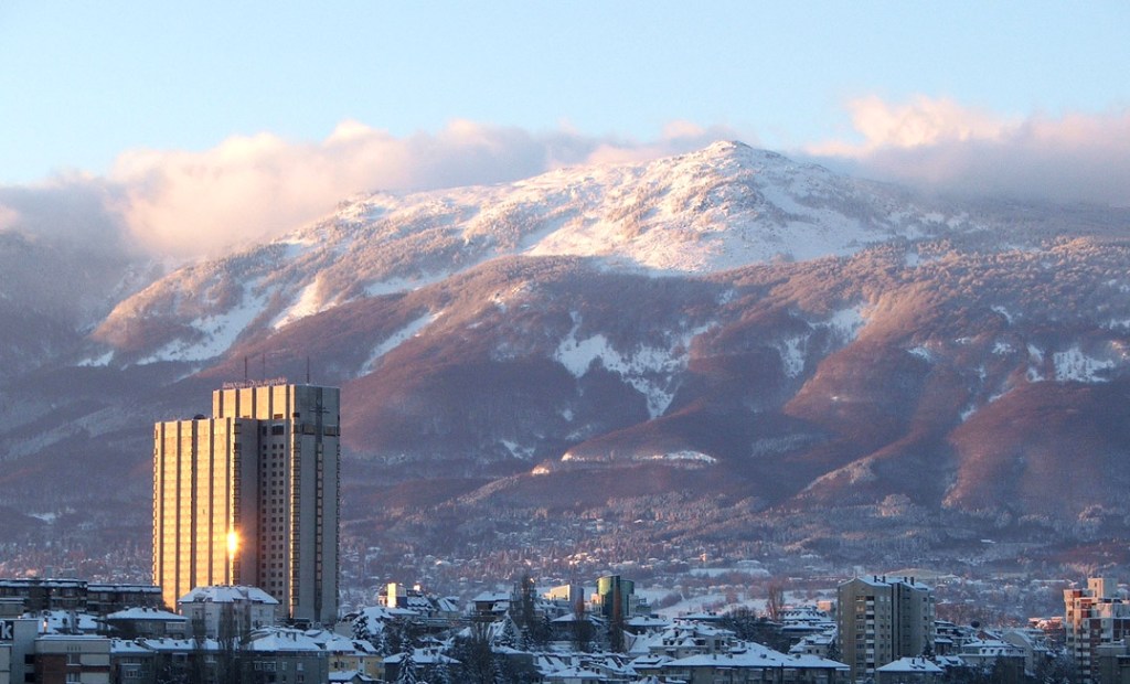
We both live in Sofia, Bulgaria’s capital city, which is located right next to Vitosha Mountain. This allows us to do regular hikes, almost on a weekly basis. Vitosha is a relatively small mountain, but it still provides many options for walks in nature.
Both my sister and I are descendants of hiking-lovers. Our maternal grandfather, whom I unfortunately don’t know (he passed away when I was just a baby), absolutely loved the mountains and spent a big part of his life roaming Rila Mountain.
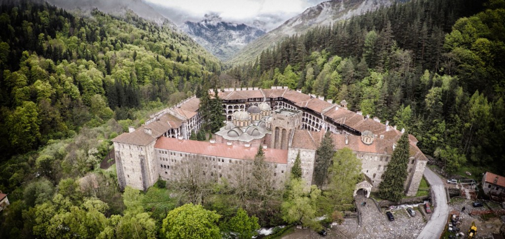
Located in the southwestern part of the country, it is the highest mountain in Bulgaria as well as on the Balkan Peninsula. Rila is loved by many for its rocky peaks, pine forests, crystal clear lakes, ski slopes, and countless breathtaking views. It is home to the spectacular Rila Monastery and the famous Seven Rila Lakes.
When our grandparents were young, they would hike up the mountain all the time. When our mom was growing up, she was also up there very often. But then she married our father and moved to a different part of Bulgaria. A few years later our grandfather died and somewhere along the way the chain of hiking was broken. But I guess, my sister and I inherited the hiker genes nonetheless and the absolute love for Rila Mountain, so the chain was slowly restored in the past years.
No one really took us hiking much when we were kids. But obliged by my university to choose a sport for credit, I ended up applying for ‘mountaineering’. Probably the best decision I have ever made!
Little by little, I started hiking outside of ‘class’ and got my sister into it, as well. And just like that, hiking became a part of our lives and I dare say a necessity. And it was three years ago, in August, when we did our first 3-day hike in Rila Mountain. We loved it so much that last August we did another 3-day hike. And we totally couldn’t imagine this August without a hike in Rila Mountain.
This time, however, we visited it for 4 days. Our lowest point (Sapareva banya) was about 750 m and we climbed to a maximum of 2,729 m on Malyovitsa Peak. So basically, we faced everything from unbearable heat to thick fog, strong wind, and some rain.
If you’re interested in our journey and the places we visited, you can read all about it below (+ lots of photographs)!
DAY 1 (23/08/25): Sapareva banya → Panichishte → Zeleni Preslap → Skakavitsa Hut
Our ascent started in the town of Sapareva banya. However, our journey began in Sofia. My sister’s boyfriend was kind enough to get up very early in the morning and give us a ride to the bus station, so we caught a bus at 7:50 a.m.
The bus’ final destination was in the city of Dupnitsa. From there we caught another bus, which goes to Sapareva banya. We had to walk a little through the town to get to the beginning of the trail. It’s funny because it goes by a public swimming pool, and when you’re already starting to sweat from the heat, it kind of makes you want to switch from hiking to swimming. And it is even more tempting, because the pool is right next to a forest.
Having defeated the temptation, we continued forward upon our way. At the beginning, it was very flat, gradually becoming steeper with some quite challenging areas. No need to say I had to defeat the temptation a few more times. 😂
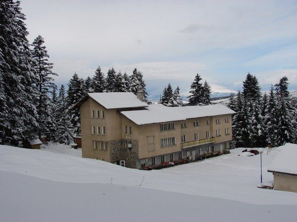
Around noon we reached the mountain resort Panichishte, which is about 1,350-1,450 m high, so the situation was more bearable. We took a break there, cooled down, had some food, refilled our water bottles, and quickly checked the exhibition at the Information Center.
Panichishte is a small resort village filled with hotels, huts, chalets, and bungalows, offering opportunities for mountain tourism throughout the entire year, including skiing.
In the Information Center there are a couple of models: one showing the entire Rila National Park and another showing just the Seven Rila Lakes area. You can visit it for free and this time they also had an exhibition with various photos taken throughout the mountain.
When we rested enough, we continued up towards Zeleni Preslap – another resort village, just smaller and less popular. A thick layer of clouds covered the sky, cooling down the air, which is always very much welcome when you’re climbing mountains in summer. We had some steep ascending until we reached a region called Gyundera. Then we had to walk upon the road for a little while before entering the forest again – a nice break before the next steep ascent.
In the early afternoon, we reached Zeleni Preslap where we took another break and sort of had a second lunch. Always remember to regularly eat food when hiking, because we burn a lot of calories, especially when climbing!
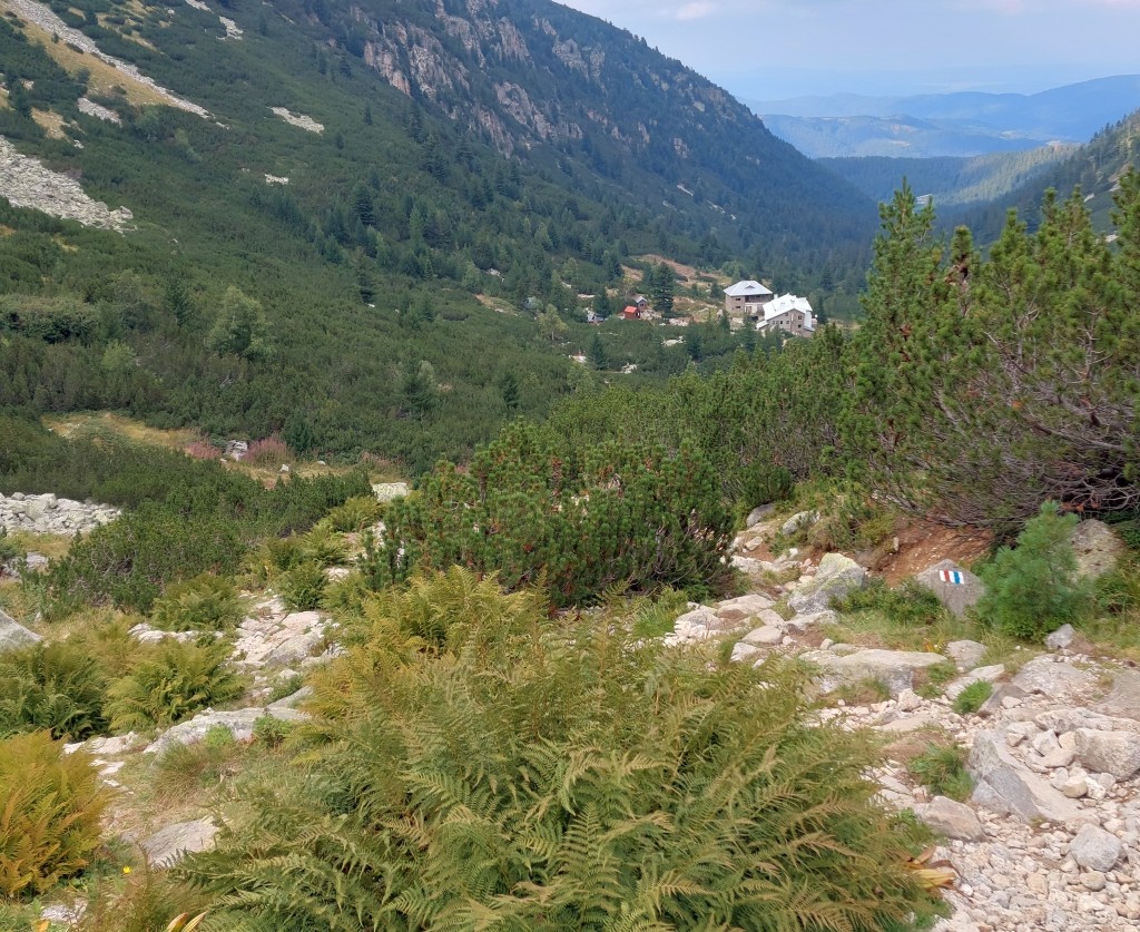
You can reach Zeleni Preslap by car, so the trail to Skakavitsa Hut officially starts there. At the beginning, it is a dirt road for a little while and then a sharp right turn gets you back in the forest. The path is quite flat at the beginning, but it gradually becomes very steep and eventually you ascend a rocky terrain.
The path to the hut itself gets harder and harder the closer you get to it. And when you had been climbing the entire day, like us, it feels like you’d never reach the top.
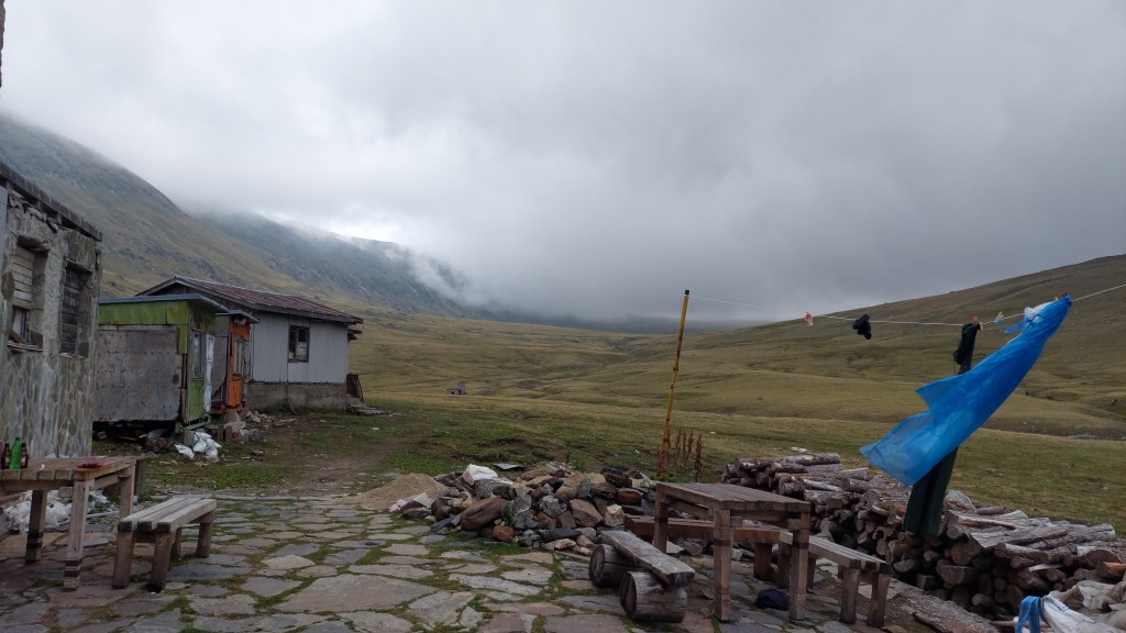
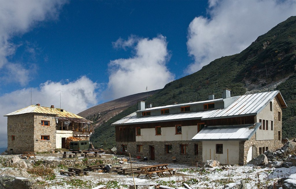
Well, ultimately, we did reach Skakavitsa Hut! 😅
Located at an altitude of 1,876 m, it is the very first hut built in Bulgaria, between 1921 and 1922, by members of the Tourist Union of Dupnitsa and other volunteers.
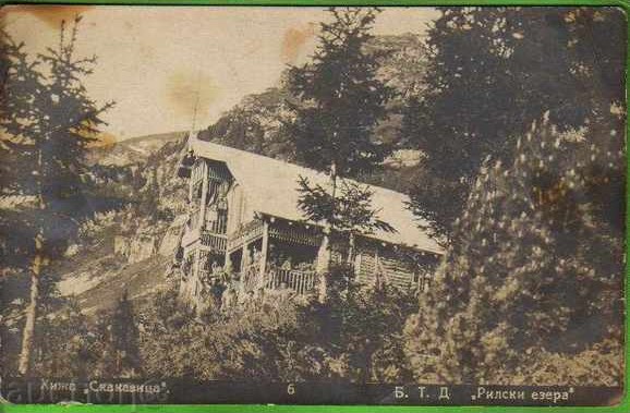
Initially, the hut was nothing more than a small, wooden, two-story building, but it was a real pride for the locals. Unfortunately, this first building was completely destroyed by a fire in 1951. The very same year, however, the construction of a new one began, which stands solid till today.

We reached the hut early enough to have time to walk around. There is a path towards Skakavitsa Waterfall, some half an hour away. The hut is actually named after the waterfall, which is the highest one in Rila Mountain.

There’s also a cute little meadow very close to the hut, where you can have a picnic and enjoy the view and the fresh mountain air. A very nice place to rest after the day’s climbing.

The hut is fully functional and has a small cafeteria where you can have a proper meal. In fact, many locals regularly visit it, especially on weekends, for a nice evening in the mountains.
Right above the cafeteria there is a small area with chairs and couches where the weary hikers can rest. There are also shelves with books, decks of cards, and board games. We took a small book that contained a collection of statements about why people love those around them. My sister and I read all of them, pointing at the ones applicable to us. <3
We were very tired, so we were basically in bed by 10:00 p.m. Very unusual for both of us, but we had gotten up at around 5:30 a.m. and had hiked for many hours, so it was getting very hard to stay awake. Also, a long trail awaited us the next morning, so we were quickly sound asleep.
DAY 2 (24/08/25): Skakavitsa Hut → The Kidney Lake and The Eye Lake (part of the Seven Rila Lakes) → Otovitsa Peak → Ivan Vazov Hut
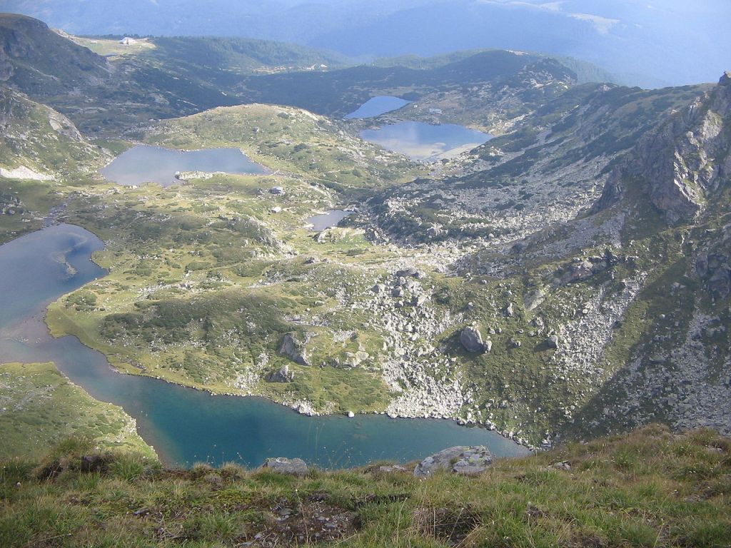
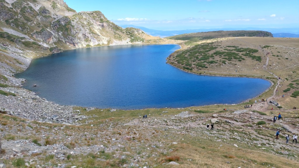
Early the next morning, we left Skakavitsa Hut and got onto the trail towards The Kidney Lake. It is part of the Seven Rila Lakes, which are a major tourist destination in Bulgaria, especially for hikers.
The lakes lie at elevations between 2,100 and 2,500 meters above sea level. Their origin is glacial, so their waters are crystal clear and cold even in summer. They offer spectacular views and lovely spots for a family picnic.
At the beginning of the trail, we were still in the woods, gradually ascending towards the lush meadows over 2,000 meters high. The air was still a little chilly, but the sky was clear, so the sun was already warming it up.
After the climbing, we got out of the forest and onto a lovely path under the warm sun rays. It was a bit windy, so I kept my jacket on. The path was flat, so the walk itself was quite perfect – we didn’t get tired because we weren’t climbing, we weren’t hot because the sun was still ascending itself, we weren’t cold because the wind wasn’t too strong, and it was just the two of us, so there was peace and quiet.
It probably lasted longer than it felt, but before we knew it, we merged with the official path between the lakes and therefore merged into the flow of people. We decided it was best to have a short break by the lake and grab something to eat. The peace and quiet was gone, but at least we had a lovely view. Also, the sun was still shining, so the weather was quite lovely.

All of the Seven Rila Lakes are named after certain characteristics they have. For example, The Kidney Lake is named such, because it has the shape of a kidney when observed from above.
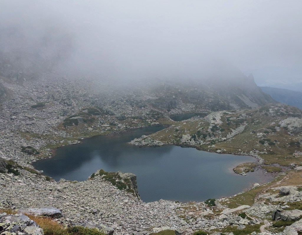
After we recharged our batteries, we ‘followed’ the crowd towards the next lake – The Eye, named such for its almost perfect oval form. It requires a steep ascent, unfortunately, upon a rocky surface. But it also grants the challengers breathtaking views as they fight for their lives.
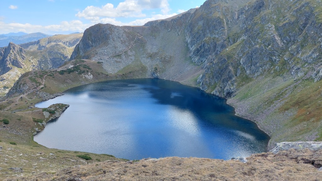
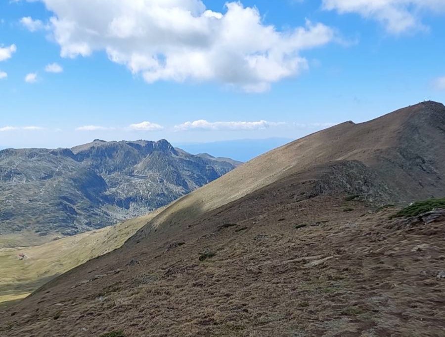
The next lake to visit is even higher than The Eye and it is basically the highest of all of the lakes – 2,535 m. If you look closely at the photo above you can see the path to that lake. It starts on the left side and continues to the right and up, ending in the middle of the photo far above The Eye. That’s where The Tear Lake is located, named such due to its clear water, which allows visibility in depth.
People who aren’t trained enough to climb often skip that one (on a 1-day hike). We also skipped it this time mainly because we were going in the opposite direction (and we visited it last year). But we didn’t skip the climbing, unfortunately.
We had to do another two sets of ascending. The first one was right next to The Eye Lake, after which we enjoyed a meadow for a nice break before the next ascent, which was very steep and rocky. It took us some time, but we got up there eventually.
Firstly, we went to a spot from where you can see all of the seven lakes.

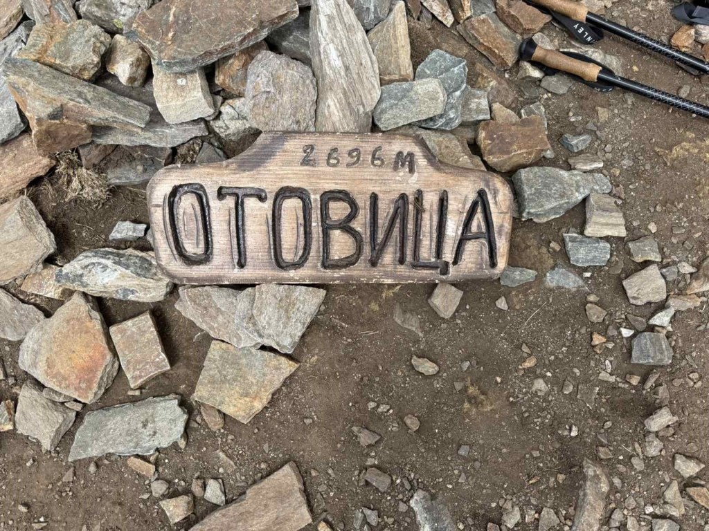
Then we did the final climbing for the day to Otovitsa Peak, located at an altitude of 2,696 m, before we continued towards Ivan Vazov Hut.
The path from Otovitsa Peak towards Ivan Vazov Hut was still sunny, but also very windy. It required a lot of walking, so we really wanted to do a break somewhere. About 30 minutes away from the hut we found a good spot for a stop, which turned out to be just perfect.
There was a large flat rock, tilted at just the right angle to lie on, as if we were in a deckchair. We lay down and almost miraculously the wind died down, as well, the sun came out, and for a moment it felt like we were on a beach rather than in the mountains. It was so relaxing that we barely stayed awake, just lying there and watching the white fluffy clouds.
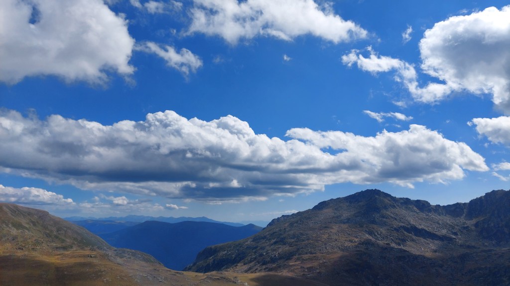
Funnily enough, at some point we sat up and the wind almost immediately picked up. We drank some water, got more comfortable and lay down again. ‘Turn off the wind,’ we said and the weather listened to us for a second time. We lay there for about 30-40 minutes altogether and, honestly, it was one of the best moments of the entire journey.
At some point I got up to search for something in my backpack and the wind picked up again to such a point that my sister was no longer comfortable lying. She ‘scolded’ me for getting up and ‘turning the wind back on’. After some laughter we decided we had rested enough, plus we were already quite tired, so we wanted to settle in the hut ASAP. We gathered our stuff and continued the descent towards Ivan Vazov Hut.
Located at an altitude of 2,300 m, it is the highest hut in Bulgaria and among the highest huts on the Balkan Peninsula. Initially, it was built as a shelter in 1939 by the Bulgarian Tourist Union. Gradually, through the years, numerous reconstructions have expanded the original building, turning it into a two-story hut with a functioning cafeteria, running water, electricity, and several rooms with beds. There are also a few bungalows and hikers are allowed to set a camping site, as well. Just be warned that there are horses and cows freely roaming the meadows around the hut!
It is named after Bulgaria’s biggest and most influental author – Ivan Vazov (1850-1921), called the ‘Patriarch of Bulgarian literature’.

My sister was very impatient to have a glass of the famous craft beer, which they offer there. So soon after we had settled in our room, we were in the cafeteria for a beer and dinner.
Also, on last year’s hike my sister wanted to make a time lapse video of the sunset – there’s a really beautiful spot some 5 minutes away from the hut for watching the sunset. But back then she faced an unfortunate failure – it would seem she had run out of space in the middle of the video, but none of us had noticed. At the end, she had a time lapse video of the sun approaching the horizon, but ‘stopping’ far above it. We laughed about it, but still we swore we’d come back this year and ‘fix’ this.
And so we did!
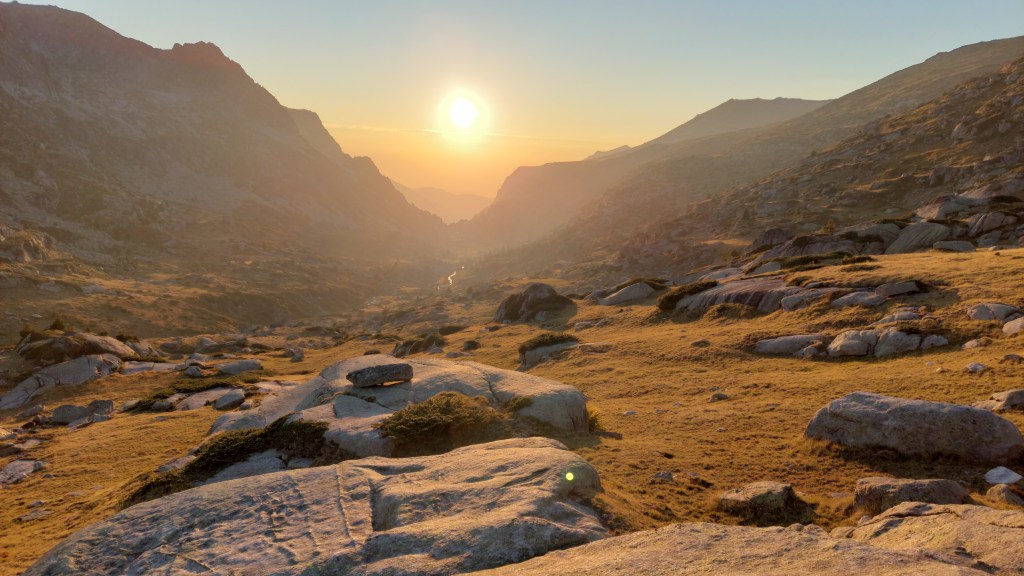
You can see my sister’s time lapse video on Instagram 💛
The moment the sun set, it rapidly became really cold, so we, just as rapidly, walked back to the hut. My sister ordered another beer and opened up a pack of crackers. Was it because I hadn’t eaten this type of snack in a long time or was it because hiking opens up the appetite, but it felt like those were the most delicious crackers ever! 😂
Wondering what to do until bedtime we discovered there was a set of scrabble by the tables. Neither of us had played the game beforehand, but we figured out the rules and found out it’s really hard to think of words when you’ve hiked the entire day and you’re very tired! 😂
DAY 3 (25/08/25): Ivan Vazov Hut → Dodov Peak → Malyovitsa Peak → Malyovitsa Hut
Now, that day was quite the adventure! We already knew the forecast didn’t promise nice weather, so at least we were prepared!
Ivan Vazov Hut is located in a valley, so it is fairly protected by the surrounding hills, but we weren’t going to stay there for the day. Nope – our path was right towards the fog.
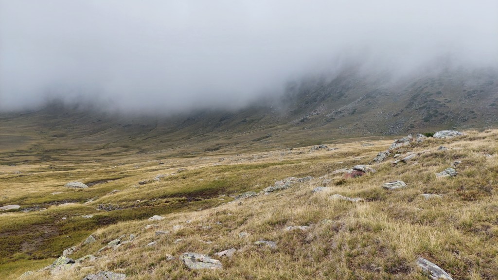
Upon our way, while still close to the hut, the fog was moving quickly around us. I noticed something intriguing, which we were about to pass by on our left. The wind cleared the morning mist for a moment and I realized what it was.
‘Look over there! I think it’s a skeleton!’ I shouted to my sister, who quickly turned to her left.
We couldn’t help but go and check. It wasn’t the first time we’d seen a dead animal (such as a mouse or a mole), a few bones, or a pile of feathers, but this sight was for the first time – a fresh corpse of a horse.
We were quite interested, but also kinda disgusted. The skin upon its legs and head was still there, which we deduced probably meant the horse was eaten the night before.
If you’re interested, as well, you can see a photo on my Instagram page. Just go through the Rila Hike ’25 Highlight collection, it is the last story (there’s a warning before it).
I felt a bit uneasy. The horse was most probably eaten by a bear or a pack of wolves and I didn’t like the thought very much. Especially in the thick fog. But wild animals are prone to avoid humans, especially during the day, so I decided not to think about it too much.
Anyway, after the unexpected stop we continued on our way. It was still very early in the morning and also still very cold. Ivan Vazov Hut is at 2,300 m above sea level, and we were only going to get even higher, so I naturally questioned myself: ‘Why didn’t I bring my gloves?’ The answer was: ‘Because it felt ridiculous to pack both a tank top and gloves.’
Lesson learned – my poor hands were quite red and stiff from the cold. At least I had proper warm, windproof clothes, as we mostly walked along the ridge of the mountain (i.e., I’m glad I didn’t get blown away 😂).
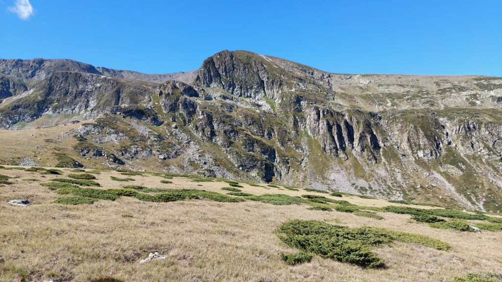
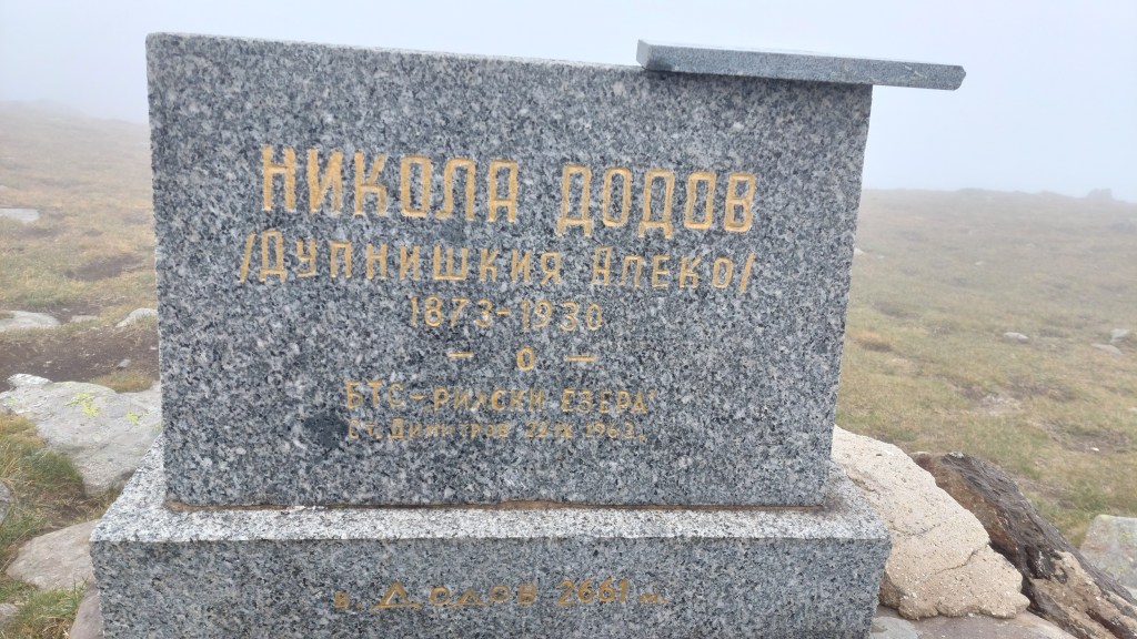
The trail took us first to Dodov Peak, named after Nikola Dodov – the founder of the Tourist Union of Dupnitsa and the initiator of the building of Skakavitsa Hut. He was also the author of the first embossed map of Rila Mountain.
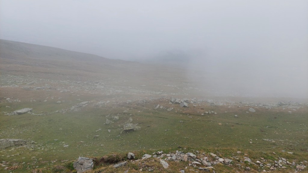
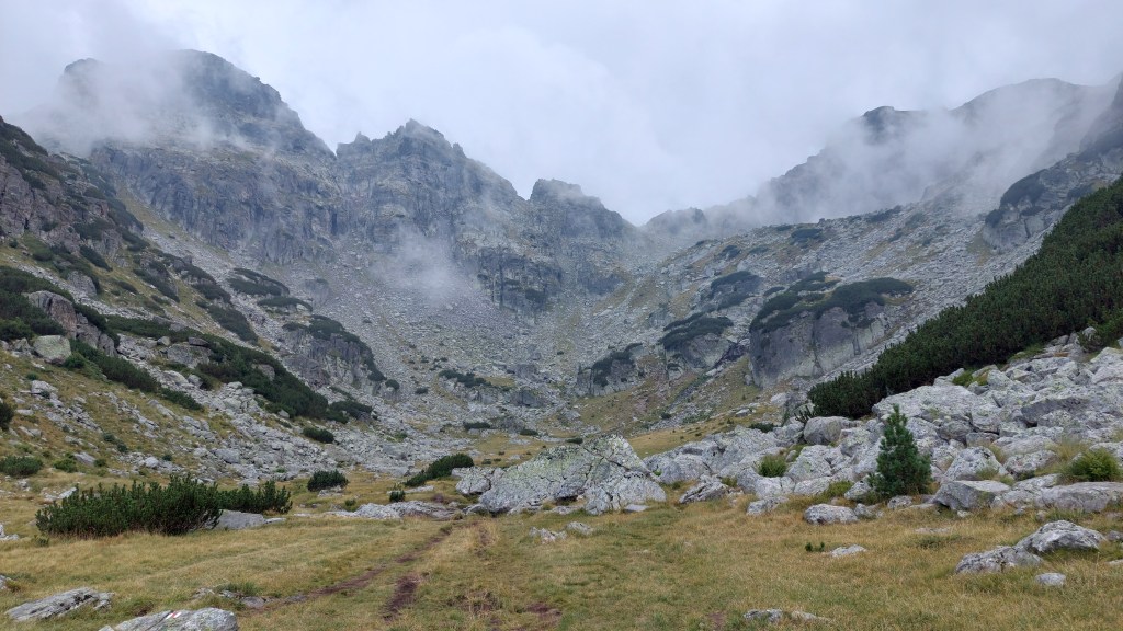
Unfortunately, we couldn’t enjoy the beautiful view from the ridge because we were constantly ‘in the clouds’. We could only see about 5-10 meters around us for most of the time.
It has its charm, though. It does look cool and you can see how quickly the fog itself is moving. One moment you barely see in front of yourself and literally a second later it gets perfectly clear in a radius of 50-100 m. And then, just as abruptly, a ‘new fog’ spreads over and you barely see in front of yourself again. It’s quite magical, honestly.
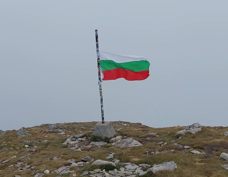
The climbing part seemed like forever, but eventually we made it to Malyovitsa Peak, which promises breathtaking views. Yeah, well…
You can’t order the weather up there, so you get what you get and sometimes you get to walk amongst the clouds. 😂

You can also see a video on my Instagram page.
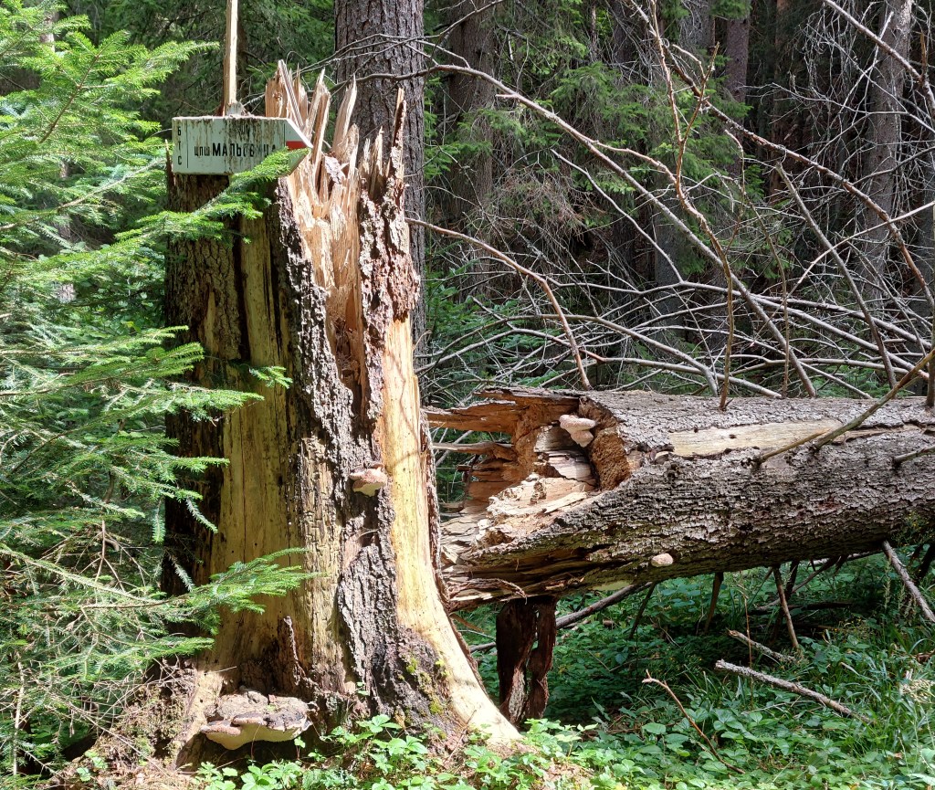
There are a couple of legends about how the peak got its name. One says it comes from Malyo voivoda (in Bulgarian: Мальо войвода) — a freedom fighter who stood against the Ottoman oppressors and died somewhere in the valleys of the region. Another legend says the name originates from the so-called Malite Lakes — a name mountaineers gave to the small lakes lying at the northeastern foot of the peak.
After visiting the peak, our descent towards Malyovitsa Hut began. And dear God, I think it’s fair to say it was the hardest descent I’ve ever done – the terrain was soooooo rocky!
Also, my sister kept on joking it was actually better with the fog, because we couldn’t see how steep the cliffs we walked upon were. In general, I’m not afraid of heights, but perhaps she was right. I don’t know how I would have felt seeing what was waiting for me in case I tripped or slipped! 😂


It was our third day of long hikes with heavy backpacks, so we were even extra tired. On top of that, it lightly rained for like 5 minutes, basically just to get the rocks wet and slippery. 😑
I just kept on praying for survival that day! 😂
At some point we descended (with great torment) enough and the fog remained above us. We got to a beautiful valley, surrounded by tall steep cliffs.
And while we were basically crawling from one rock to another, we stumbled upon a mountain goat.

Fascinated and intrigued we took our time for some photos until we got too close and the goat fled away. But it turned out it wasn’t the only one out there, enjoying the lack of humans From that moment on, and even near Malyovitsa Hut, we saw a lot of mountain goats grazing and hopping around. Yeah – us crawling, them hopping happily about. My sister and I kept joking that they were probably mocking us in their minds — ‘Stupid humans can’t even walk on the rocks.’ *hop* *hop* *hop*
You can see a video of one of those goats on my Instagram page 🦌
Towards the end of our adventure, we were almost crawling even on flat ground. We were so tired that it took us forever to reach the hut, even after we were done with the rocky terrain.
With even greater torment we made it at the end! 😅
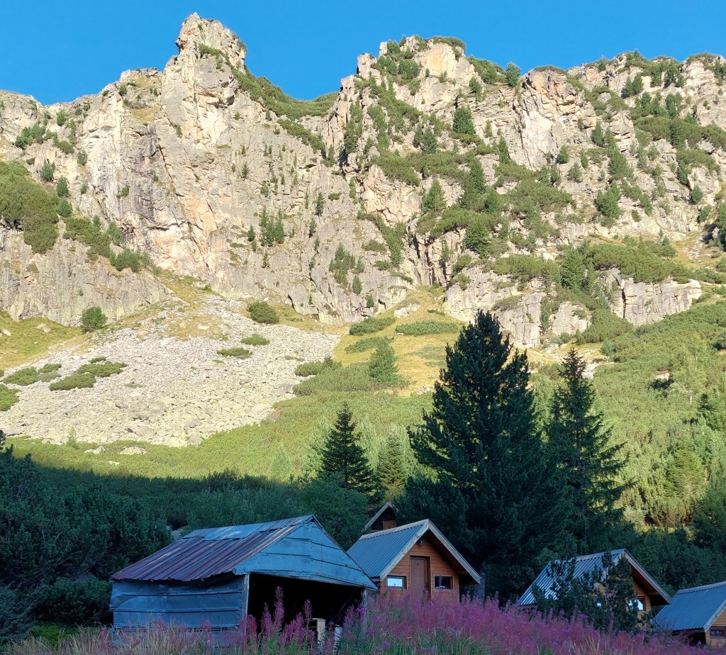
Malyovitsa Hut was also initially built as a shelter in 1934 by the Tourist Union of Pernik. Nowadays, there are two main buildings and seven bungalows. It is one of the most visited huts, because it can easily be reached by car and a bit of climbing. About 2.75 km away from the hut there’s a small resort with hotels and plenty of tourism options, such as skiing. You can leave your car there, and in about an hour or so you can reach Malyovitsa Hut. It is fully functional with a cafeteria, running water, electricity, lots of rooms and even hot water! That’s quite luxurious for this type of mountain hut.
I have never felt so relieved to lie down as on that day. I’m still surprised at myself for surviving it. 😂
In the evening, we gladly had dinner at the cafeteria and enjoyed a game of cards, while recovering from the day’s hike. Needless to say we were in bed quite early recharging for the final hiking the next day.
DAY 4 (26/08/25): Malyovitsa Hut → Vada Hut → Sapareva banya
When I woke up the next morning, the last thing I wanted for the day was to go down. And that was mainly because I was already sooooo tired I didn’t feel like hiking at all. 😂
But also because I didn’t want to leave that beautiful place!
But we had no choice – our vacation was over and with much grief we proceeded downwards…
…and had to do a stop almost immediately, because my, oh my, there were sooooo many raspberry bushes!
Basically, raspberries are my favorite fruit, so it was impossible to miss this opportunity and simply pass them by. My sister gave me her foldable cup and I picked as many as I could. When I was done, we continued on our way towards Vada Hut and I enjoyed the delicious wild berries while walking.
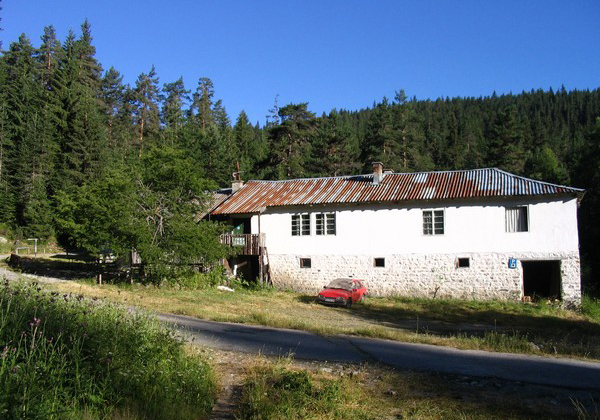
Located at the foot of Rila Mountain – at an altitude of 1,470 m, Vada Hut is a small and cozy 1-story building, which offers peace and quiet to all the visitors. It’s a perfect place to stop for a break and enjoy one of the delicious meals the kitchen offers before continuing on your longer journeys. There are also a few rooms, so one could spend the night there, as well.
The trail towards the hut was so very lovely that we reached it almost imperceptibly.
And we got there just in time for a delicious lunch. We had some bean stew (a typical Bulgarian dish), meatballs and bread, and recharged very nicely for we had quite some more distance to walk.
When we rested enough we continued our descent by… climbing. LOL
Vada Hut is in such a location that the trail included some ascending, as well. My tired legs weren’t very happy about it, but they’re trained enough, so little by little we made it through this part of the path.
After about an hour or so, we reached the bottom station of the chairlift, which takes tourists up to the Seven Rila Lakes. Actually, the very first time I visited the lakes, I was a kid – our parents took my sister and me on such a trip for a day. Back then, I still wasn’t a proper hiker and didn’t have proper equipment, so I was completely beaten at the end. I don’t remember enjoying that hike very much. It’s funny how things change, especially when they happen at the right time.
There is another hut very close to the chairlift – Pionerska Hut. It is also fully functional and has a ski track nearby, so it sees a lot of tourists throughout the entire year.
We had a short break near the chairlift and then continued walking on the road until we merged onto the initial trail from the first day – just this time we were going down towards Sapareva banya. We were in a hurry, so we didn’t do any more stops on the way. Our legs were so tired and, honestly, the closer we got to the town, the more we feared me might miss the bus to Dupnitsa at 5:05 p.m. Needless to say we were literally running at the end. 😂
Luckily for us, we made it right on time (actually, we even had to wait a few minutes). The bus took us back to Dupnitsa from where we caught another one to Sofia. Had we missed this bus, we would have had to wait 2 hours until the next possible transportation, so ‘phew’ for catching it. 😅
I was at home at around 8:00 p.m. where I found myself daydreaming about Malyovitsa Hut, which we had left exactly 12 hours ago. It’s always hard for me to go back to reality after I have spent some days in the mountains. 😥
Well, these are the highlights from this year’s Rila Mountain hike, which I did with my sister! Would we do another one next August? Only time will show. In the meantime, there are many other options for hiking. But it’s really hard to resist visiting my beloved Rila Mountain! <3
Till the next time!
Lina Dimitrova
10/11/25